FRONTIER FORTS
Frontier Forts
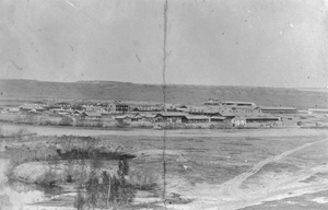
View largerBritish, Canadian, French, Spanish, and American forts were distributed from the Prairie Provinces to West Texas and from the Missouri River to the Rocky Mountains, although not evenly and not all having a strictly military purpose. In the early nineteenth century, American forts helped to secure and maintain sovereignty in the face of Native American opposition and European schemes to limit the new nation's expansion. Outposts proved a critical line of defense in the south, especially after the Mexican War, 1846–48, but not in the Northern Plains, where the long international border lay virtually undefended.
Broadly defined, Great Plains forts fell into two groups. Forts of the first group were places from which to carry on commerce, a staging area for traders of furs and robes. Forts of the second group, detailed here, were places from which to execute war, a staging area for soldiers. Fort Leavenworth (1827), Kansas, for example, the oldest active army post west of the Mississippi, was the starting point for several western explorations. Camp Supply (1868) in present-day Oklahoma served as George A. Custer's departure point for a punitive expedition against the Southern Cheyennes. Fort Abraham Lincoln (1872), North Dakota, played a similar–and less successful–role in 1876 in Custer's foray against the northern tribes. Fort Laramie, which passed from private to public ownership in 1849, became an administrative center at which to negotiate peace, the Fort Laramie Treaty of 1868 its most notable legacy.
Great Plains forts invariably stood at strategic points on the landscape, based on four relationships: to Native American groups; to predominantly east–west transportation lines and communication networks; to burgeoning settlements and urban centers; and to the military chain of command. Since the Plains Indians posed the greatest barrier to westward expansion in the United States, most American forts were located in this region and became, as Gen. William T. Sherman proclaimed, "a picket line of civilization."
Forts were concentrated along historic transportation and communication routes, including the Arkansas, Missouri, Platte, Rio Grande, and Yellowstone Rivers, the Bozeman, Oregon-California, Santa Fe, Smoky Hill, and Southern Overland Trails, the Butterfield Overland Mail and Pacific Telegraph lines, and the Kansas Pacific, Northern Pacific, Southern Pacific, Union Pacific, and Santa Fe Railroads. Fort Dodge (1865), Kansas, first guarded the Santa Fe Trail, then the Santa Fe rail line. Fort Wallace (1865), Kansas, experienced the same transformation when the nearby Kansas Pacific Railroad replaced the Smoky Hill Trail.
As the country looked to the Pacific Coast, the command structure of the U.S. Army and its system of posts, subposts, and cantonments reflected this east–west shift. Omaha, Nebraska, the terminus of the Union Pacific and site of Fort Omaha (1868), also headquartered the Department of the Platte. St. Paul, Minnesota, shared the same relationship with the Department of Dakota and the Northern Pacific and Great Northern Railroads. Both military departments, in turn, reported up the chain to Division of the Missouri headquarters in Chicago, the preeminent rail, commercial, and industrial center in the Midwest.
The history of American forts in the Great Plains falls into three time periods, each roughly bracketed by wars (War of 1812, Mexican War, Civil War, and Spanish-American War). These events focused the attention of the U.S. Army on new enemies and new missions.
The first period is defined by the early posts, which extended north–south from Fort Snelling (1819), Minnesota, to Fort Jesup (1822), Louisiana. Others in this chain included Fort Atkinson (founded in 1819 as Cantonment Missouri) and the first Fort Kearny (1846) on the Missouri River in Nebraska; Fort Leavenworth and Fort Scott (1842), Kansas; Fort Gibson (1824), Fort Towson (1824), and Fort Washita, Oklahoma; and Fort Smith (1817), Arkansas. The early forts were successful in their limited purposes–to protect settlers, to control Native Americans, and to foster the growth of the fur trade. The period concluded with hostilities with Mexico, the annexation of Texas, and the discovery of California gold. With the passage of the Kansas-Nebraska Act in 1854 and the opening of Indian Country to settlers, the emphasis changed from an impenetrable north–south barricade between Native Americans and frontier whites to safe east–west travel corridors for emigrants and entrepreneurs.
Two Platte River forts, the second Fort Kearny and Fort Laramie, define the early years of the second period. To the annoyance of their commanders, emigrants came to depend upon these outposts for essential services such as resupply, medical attention, and blacksmithing. Increased traffic also resulted in more armed conflicts with Native Americans, which in turn increased the military resources poured into the Plains. Such forts symbolized a continual compromise by the army–building large, fixed posts to fight a mobile people, or at least to encourage them with treaty-secured inducements to live away from the trails. Ultimately, the forts that guarded the trails, and their countless feeder lines and alternates, proved more valuable as bases of operations against the Native Americans than as purely defensive systems.
Threats of trail closure in the 1850s came from the Lakotas on the Oregon-California Trail, the Cheyennes on the Smoky Hill Trail, and the Comanches and Kiowas on the Santa Fe Trail. Indian threats, combined with international disputes, provoked the greatest military response, in terms of sheer numbers of new forts, on the expanding Texas frontier. There, an elaborate defense system protected Texans from raiders and defined the southwestern military frontier. The initial chain of forts in central Texas ran northeast–southwest, from the Red River to the Rio Grande, from Fort Washita to Fort Worth, Fort Graham, Fort Gates, Fort Croghan, Fort Inge, and Fort Duncan (all six founded in 1849). The next set shifted west, still running northeast–southwest, consisting of Forts Belknap on the Brazos River (1851), Phantom Hill (1851), Chadbourne (1852), McKavett (1852), Mason (1851), and Clark (1852) near the Rio Grande. Another line ran from the Rio Grande west, from Fort Davis (1854) to Fort Bliss (1848) to Santa Fe's Fort Marcy (1846), each designed first to counter the Mexican Army, then to control area tribes. New Mexico boasted its own string of forts along the Rio Grande and the El Paso–Santa Fe Road, including Forts Craig (1854), McRae (1863), and Selden (1865). This massive infrastructure also ensured a continuous line of communication across the southern part of the trans-Mississippi West.
In the 1850s the Santa Fe Trail became truly a military road, besides a route for emigration and commerce, beginning with Kansas's Fort Riley (1853) and Fort Larned (1859) and ending with Colorado's Fort Lyon (1860) and New Mexico's Fort Union (1851). A bustling center of frontier defense in the Southwest for four decades, Fort Union was the largest U.S. military post and supply depot in the region. To the north, the navigable reaches of the Missouri River had a string of forts: Fort Pierre (1855), replaced by Fort Randall (1856), and Forts Sully (1863), Rice (1864), Stevenson (1867), Buford (1866), Bennett (1870), Abraham Lincoln (1872), and Yates (1874). At the fringe of the Great Plains, Fort Abercrombie (1858) guarded the head of navigation on the Red River of the North.
The Civil War drew off regular army garrisons from the Plains, and Confederate and volunteer surrogates proved to be poor replacements. Native Americans were successful in closing some routes, most notably the Platte Valley route in 1864–65 and later the Bozeman Trail. Fort Fetterman (1867), Wyoming Territory, assumed even greater importance when the army bowed to Indian demands and abandoned the three Bozeman forts farther north–Reno (1865), Phil Kearny (1866), and C. F. Smith (1866); all were burned to the ground in 1868.
The post–Civil War period, when railroads supplanted the trails, was a time of clear military objectives. The army regarrisoned its forts to protect railroad construction crews and later the masses of settlers the new lines brought west. Forts lined the Union Pacific Railroad from Omaha to the Rockies: Forts Omaha, Kearny, McPherson (1863), and Sidney (1867) in Nebraska; Fort Sedgwick (1864) in Colorado; and Forts Bridger (1858), Sanders (1866), D. A. Russell (1867), and Fred Steele (1868) in Wyoming. Ironically a fort's success in protecting railroad construction crews and promoting settlement usually led to its obsolescence.
In post-Civil War Texas, new forts were established–Forts Concho, Griffin, and Richardson in 1867–and old ones reactivated. Forts Stockton (1858), Davis, Quitman (1858), and Bliss. They joined Forts Clark and McKavett in an irregular line running from El Paso to the state's northeast border. Just to the north, Fort Sill (1869) guarded the nearby Kiowa-Comanche Agency. Fort Reno and the Darlington Agency for the Cheyennes and Arapahos were no longer at the frontier's edge, but now in the center of Indian Territory. Fort Sill became a major base from which the Red River War (1874-75) could be waged, ending armed resistance from the Southern Plains tribes. With Fort Laramie as its major base, the Sioux War of 1876-77 accomplished the same in the Northern Plains, after which few new significant posts were established. Fort Assiniboine (1879), Montana, was founded to keep the Lakota leader Sitting Bull, not Canadians, in Canada. Across the border the North-West Mounted Police formed in 1873 and established several outposts in the Prairie region, most notably Fort Macleod (1874), Alberta, and Fort Walsh (1875), Saskatchewan. Together with the occasional subpost on the international border, their slim garrisons sought to prevent smuggling, intertribal clashes, and the introduction of diseased American cattle. It was more police than military work.
The 1880s brought consolidation of the American forts, regiment-sized garrisons, and the replacement of many small posts. The ring of "guardian forts" around the Indian reservations tightened. In the Northern Plains these were Fort Niobrara (1880) and Fort Robinson (1874), Nebraska; Fort Meade (1878), South Dakota; Fort Custer (1877) and Fort Keogh (1876), Montana; and Fort Washakie (1869), Wyoming. With large forts now placed in urban centers, such as Denver's Fort Logan (1887) and Omaha's Fort Crook (1891), authorities had a handy police force to quell civil disturbances.
By the time of the Spanish-American War in 1898 there were barely a dozen posts in the Northern Plains, as compared to three dozen in 1880. Troops–and forts–were spread more or less equally over the entire nation. The military frontier in the Great Plains was closed.
See also ARCHITECTURE: Fort Architecture.
R. Eli Paul Nebraska State Historical Society
Prucha, Francis Paul. A Guide to the Military Posts of the United States, 1789–1895. Madison: State Historical Society of Wisconsin, 1964.
Utley, Robert M. Frontier Regulars: The United States Army and the Indian, 1866–1891. New York: Macmillan Publishing Company, 1973.
Utley, Robert M. Frontiersmen in Blue: The United States Army and the Indian, 1848–1865. New York: Macmillan Publishing Company, 1967.
Previous: Fremont, John C. | Contents | Next: Galvanized Yankees
XML: egp.war.017.xml